|
Near Grand Marais remains of an Indian campsite were found, as well as tools made from copper, bone and stone there.
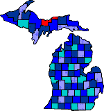
The county got its name from Russell Alger, governor of Michigan from 1885-86.
Prior to the first white settlers, fur traders and fishermen explored the area.
Up until 1855 the Chippewa Indians had reservations on Grand Island and in the Munising area.
The American Fur Company built a post on Grand Island in the mid 1820's.
Most of Alger county land was included in the transfer of lands by the Chippewa to the US Government in 1836.
Munising began its settlement around 1850, but the development was slow because of the areas isolation.
Today forest related industries are still a major part of Alger county. Although noted mostly for tourism other industries include farming, dairying, sand and gravel.
The Hiawatha National Forest comprises most of the County, which include many waterfalls, trout streams and inland lakes.
One of the most famous areas is the multi-colored cliffs which span fifteen miles along Lake Superior which is known as the Pictured Rocks National Shoreline.
|