Michiganweb - Michigan Info Net

ANTRIM COUNTY MICHIGAN


Antrim county map

Size: 476 Square Miles
Elevation: 600-1400 Feet
Physiography: Hill-lands; Plains
Growing Season: 100-130 days
Annual Precipitation: 30-33 inches
Average Snowfall: 80-120 inches
Forest Type: Aspen-Birch, Maple-Beech-Hemlock
Fall Colors: Late September to Early October

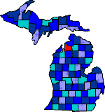
The county was named after an Ireland county. The first white men arrived in at the mouth of the Elk River in 1839. A saw mill was built in 1860 where the village of Elk Rapids grew. After a few years Dexter and Noble took over the mill. They owned most of the hotels, steamboat runs, many sawmills, as well as thousands of acres of lakeshore land. Mancelona became a major railroad stop. Today Antrim is known for its summer resorts and cherry orchards. The 18 mile long Torch Lake is named by the National Geographic Society as one of the nation's most beautiful lakes. Torch Lake got its name from Native Americans who hunted fish by torch light.

Alba (49611) Alden (49612) Antrim
Atwood Bellaire (49615) Central Lake (49622)
Chestonia Creswell Eastport (49627)
Elk Lake Elk Rapids (49629) Ellsworth (49729)
Farmdale Finkton Hitchcock
Kewadin (49648) Mancelona (49659) North Arms
North Lake Pleasant Valley Torch Lake
Wetzel blank blank


Main Page Disclaimer

Copyright | 2021 | michiganweb.com