|
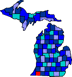
The county is named after Lewis Cass who was the Territorial Governor of Michigan
from 1813-31. In the 1820's white settlers occupied the Potawatomis territory.
US-12 was once an Indian trail that crossed the country from east to west. Along the
banks of the Christiana and Dowagiac Creeks burial mounds were found that dated back to 100 B.C.
Many settlers came from Niles in Berrien County. Settlers included New Englanders, Southerners, and
a large Black and Indian population. Although most Potawatomis were forced off their land,
some Native Americans resisted, and in 1837 were able to purchase 1,000 acres of land in
Silver Creek Township. Many descendants can still be found living there today. The Black
population was aided by the Quakers who had left the South due to slavery. The had helped slaves
escape through the underground railroad. About 2 miles east of Cassopolis is The William Jones House,
a station for the underground railroad. Dowagiac (from the Potawatomi word meaning "foraging ground"
is the county's major community. The Round Oak Stove Company was founded there in 1886, which was a
manufacturer of furnaces for homes.
|