| Size: 577 Square Miles |
| Elevation: 800-1000 Feet |
| Physiography: Rolling plains |
| Growing Season: 140-160 days |
| Annual Precipitation: 31-33 inches |
| Average Snowfall: 40-60 inches |
| Forest Type: Oak-Ash-Cottonwood, Maple-Beech |
| Fall Colors: Middle October |
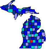
| Eaton County was named after John Eaton, Secretary of War, under President Andrew Jackson. The first settlers came to Bellevue in 1833. Eaton Rapids got its name for the rapids on the Grand River. Olivet College was founded in 1844. It was the first college to allow women and blacks. Vermontville hosts the annual maple syrup festival. |
| Ainger | Bellevue (49021) | Bismark |
| Brookfield | Carlisle | Centre |
| Charlesworth | Charlotte (48813) | Chester |
| Dellwood | Dimondale (48821) | Eaton Rapids (48827) |
| Elmira | Grand Ledge (48837) | Gresham |
| Hoytville | Kalamo | Kelly |
| Kingsland | Millett | Mulliken (48861) |
| Needmore | Olivet (49076) | Packard |
| Petrieville | Podunk | Potterville (48876) |
| Roxanna | Shaytown | Spicerville |
| Sunfield (48890) | Vermontville (49096) | Walton |
| Woodbury (48897) |
|
Copyright | 2021 | michiganweb.com
|