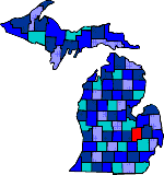

| Size: 642 Square Miles |
| Elevation: 600-900 Feet |
| Physiography: Lake border plains, rolling plains |
| Growing Season: 140-160 days |
| Annual Precipitation: 29-31 inches |
| Average Snowfall: 40-60 inches |
| Forest Type: Oak-Hickory, Elm-Ash-Cottonwood |
| Fall Colors: Early October |
| Genesse, the name meaning "beautiful valley", was named for a New York county. The first white settler to the county was Jacob Smith from Quebec. In 1819 he started a trading post on the Flint River. Construction on a military road began in 1829 that connected Detroit with Saginaw Bay. In the 1830's saw mills were built on the Thread River south of Flint. As lumbering declined, the manufacturing of carriages grew with the opening of the Durant-Dort Company. An arch was built over Saginaw street that read "Flint: Vehicle City". Soon the automobile began to replace the carriage and in 1904 Durant invested into Buick Motor Company. The growth of the auto industry increased Flint's economy. |
| Argentine | Atlas (48411) | Beecher |
| Burton | Clio (48420) | Davison (48423) |
| Duffield | Farrandville | Fenton (48430) |
| Flint | Flushing (48433) | Gaines (48436) |
| Genesee (48437) | Goodrich (48438) | Grand Blanc (48439) |
| Huntingtown | Lakeside | Lennon (48449) |
| Linden (48451) | Montrose (48457) | Mount Morris (48458) |
| Otisville (48463) | Otter Lake (48464) | Rankin |
| Rogersville | Russellville | Swartz Creek (48473) |
| Whitesburg |
|
Copyright | 2021 | michiganweb.com
|