| Pronounced: go G EE blk |
| Size: 1112 Square Miles |
| Elevation: 800-2000 Feet |
| Physiography: Highlands, Hilly Uplands |
| Growing Season: 90-130 days |
| Annual Precipitation: 32-36 inches |
| Average Snowfall: 140-180 inches |
| Forest Type: Maple-Beech-Hemlock, Aspen-Birch |
| Fall Colors: Late September |
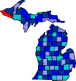
| Located in the Upper Peninsula of Michigan, bordering Wisconsin. The county was named after the Chippewa word "agogebic," meaning a body of water hanging on high. The French first explored Gogebic County. Its early residents were Indians, missionaries and trappers. Iron was discovered in 1871. With the railroad in 1884 the iron ore was shipped. Mining operations were in Ironwood, Bessemer, and Wakefield. Gegebic County economy consists of a variety of industries such as recreation, forest products, precision tools, plastic molding and service-based businesses. |
| Anvil | Bessemer (49911) | Black Siding |
| Bonifas | Cisco Lake | Connorville |
| Dunham | Ethelwood | Green |
| Hurley | Ironwood (49938) | Junet |
| Land O'Lakes | Marenisco (49947) | Orva |
| Planter | Ramsay (49959) | Sandrock |
| Siemens | Stickley | Thayer |
| Theodore | Tula | Vanbuskirk |
| Wakefield | Watersmeet | Wellington |
|
Copyright | 2021 | michiganweb.com
|