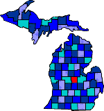
| Size: 566 Square Miles |
| Elevation: 600-800 Feet |
| Physiography: Rolling plains, lake border plains |
| Growing Season: 140-160 days |
| Annual Precipitation: 28-31 inches |
| Average Snowfall: 40-60 inches |
| Forest Type: Oak-Hickory, Aspen-Birch, Maple-Beech |
| Fall Colors: Early October |
| The County is named after Captain Charles Gratiot who was the builder of Port Huron area and Fort Gratiot. The first white settler, Arnold Payne, came in 1846. He started the Bethany Indian Mission in St Louis. Land was sold for 50 cents an acre by the US Government. This brought a lot a people to the area in a short amount of time. After the Civil War lumbering became the leading industry and then later on agriculture producing dry beans and soybeans. The city of Alma is home to Alma College and Total-Leonard Refining Company. |
| Alma (48801) | Ashley (48806) | Bannister (48807) |
| Beebe | Breckenridge (48615) | Brice |
| Bridgeville | Carson City (48811) | Edgewood |
| Elm Hall (48830) | Elwell (48832) | Eugene |
| Forest Hill | Galloway | Ithaca (48847) |
| Langport | Maple Rapids (48853) | Meridian |
| Middleton (48853) | Newark | North Star (48862) |
| Ola | Perrinton (48871) | Pompeii (48874) |
| Rathbone | Riverdale (48877) | Saint Louis (48880) |
| Sethton | Sickles | Springbrook |
| Stella | Summerton | Sumner (48889) |
| Wheeler (48862) |
|
Copyright | 2021 | michiganweb.com
|