Michiganweb - Michigan Info Net

IOSCO COUNTY MICHIGAN


Iosco county map

Size: 547 Square Miles
Elevation: 600-1000 Feet
Physiography: Hill-Lands, Lake-Border
Growing Season: 120-140 days
Annual Precipitation: 28-30 inches
Average Snowfall: 40-60 inches
Forest Type: Elm-Ash-Cottonwood, Pine, Aspen-Birch, Oak-Hickory
Fall Colors: Late September - Early October

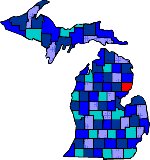
The Chippewa Indians first occupied Iosco County. Iosco is Indian for "Water of Light." The first white settlers were the French traders and trappers. They settled on the Au Sable River in 1848. In 1852 a lighthouse was built on Tawas Point. Lumbering was the major industry until a fire destroyed so much. Other industries included fishing, farming, and mining for salt and gypsum. The Au Sable River, Michigan's longest river, is known for its trout fishing and canoeing. Today, more than a third of the county is within the Huron National Forest, with Lumberman�s Monument standing as a tribute to that era.

Alabaster Au Sable (48750) East Tawas (48730)
Hale (48739) Hemlock Iosco Beach
Long Lake (48743) Meadow National City (48748)
Oscoda (48750) Sand Lake (49343) South Branch (48761)
Tawas City Turtle White Rock
Whittemore (48770) blank blank


Main Page Disclaimer

Copyright | 2021 | michiganweb.com