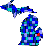
| Size: 828 Square Miles |
| Elevation: 700-1000 Feet |
| Physiography: Lake border plains, rolling plains |
| Growing Season: 140-160 days |
| Annual Precipitation: 28-30 inches |
| Average Snowfall: 40-60 inches |
| Forest Type: Oak-Hickory, Elm-Ash-Cottonwood, Maple-Beech |
| Fall Colors: Early October |
| Chippewa Indians were the earliest settlers and the first white family settled in 1828. Growth in this area was slow due to hostile Indians and lack of roads. In the 1830's the communities of Almont, Dryden, Lapeer and Whitesville were established. Lumbering from 1840-1890 helped the county to grow. The Flint River was used to get the lumber to sawmills at Bay City, Saginaw and Flint. Forest fires in 1871 and 1881 allowed the agricultural industry to grow. After World War II dairying was very important with Lapeer being the largest in Michigan. Farming is still exists today. |
| Almont (48003) | Attica (48412) | Burnside |
| Clifford (48727) | Columbiaville (48421) | Dryden (48428) |
| Elba (48446) | Five Lakes | Goodland |
| Hadley (48440) | Hunters Creek | Imlay City (48444) |
| Lapeer (48446) | Lum (48452) | Metamora (48455) |
| Millville | North Branch (48461) | Otter Lake (48464) |
| Silverwood (48760) | Thornville |
|
Copyright | 2021 | michiganweb.com
|