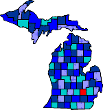

| Size: 570 Square Miles |
| Elevation: 800-1000 Feet |
| Physiography: Rolling plains, hilly uplands |
| Growing Season: 140-160 days |
| Annual Precipitation: 31-33 inches |
| Average Snowfall: 40-50 inches |
| Forest Type: Oak-Hickory, Maple-Beech |
| Fall Colors: Middle October |
| Livingston county is named after Edward Livings, President Andrew Jackson's Secretary of State. The first settlers came in 1828. Prior to this time the land was farmed by Chippewa and Potawatomi Indians. In the 1830's many of the white settlers arrived via the Grand River Trail which is now known as Grand River Road. In 1852 a plank road was constructed between Detroit and Lansing. This ran through the city of Howell. This toll road ran along the Grand River Trail with toll gates every five miles. After World War II the Livingston area became a haven for wanting to get away from city life. In the 1970's this county was one of Michigan's fastest growing counties. |
| Anderson | Brighton (48116) | Chilson |
| Cohoctah (48816) | Crooked Lake (48116) | Fowlerville (48836) |
| Green Oak | Gregory (48137) | Hamburg (48139) |
| Hartland (48353) | Hell (48169) | Howell |
| Lakeland (48143) | Oakgrove (48863) | Parkers Corner (48892) |
| Parshaville (48430) | Pettysville (48169) | Pinckney (48169) |
| Plainfield (48137) | Rushton | Tyrone Center (48430) |
| Unadilla (48137) |
|
Copyright | 2021 | michiganweb.com
|