| Size: 1014 Square Miles |
| Elevation: 600-900 Feet |
| Physiography: Lake-border-plains, rolling plains |
| Growing Season: 120-140 days |
| Annual Precipitation: 30-32 inches |
| Average Snowfall: 90-120 inches |
| Forest Type: Maple-Hemlock, Aspen-Birch, Spruce-Fir |
| Fall Colors: Late September |
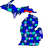
| The northern end of Mackinaw Bridge connects to this County. In 1671 Father Jacque Marquette established an Indian mission named St Ignace. The French built Fort Michilimackinac which was taken over by the British and moved to Mackinac Island. The Treaty of Paris made the Straits of Mackinac part of the United States in 1783. Mackinac County industries included fur trading, lumbering and fishing. |
| Bois Blanc Island (49775) | Cedarville (49719) | Curtis (49820) |
| Engadine (49827) | Gould City (49838) | Hessel (49745) |
| Mackinac Island (49757) | Moran (49760) | Naubinway (49762) |
| Point Aux Pins (49775) | St Ignace (49781) |
|
Copyright | 2021 | michiganweb.com
|