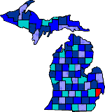

| Pronounced: MA COMB |
| Size: 458 Square Miles |
| Elevation: 600-800 Feet |
| Physiography: Rolling plains, lake border |
| Growing Season: 150-180 days |
| Annual Precipitation: 28-31 inches |
| Average Snowfall: 40 inches |
| Forest Type: Oak-Hickory, Maple-Beech, Elm-Ash-Cottonwood |
| Fall Colors: Middle October |
| Named after the War of 1812 hero General Alexander Macomb. In 1800 Christian Clemens bought land on the Clinton River. Most of this land had been farmed by Native Americans. With the erection of a distillery other settlers came to the area. In 1873 salty mineral waters were used. Many bath houses were built because of the therapeutic value of this salt water. Selfridge Field was used to train pilots for the Army Air Corps. The Chrysler Tank Plant was built in Warren. Today Macomb County is the leader in producing autos, chemicals, and missiles. |
| Armada (48005) | Bruce (48065) | Centerline |
| Chesterfield | Clinton Twp | Davis (48094) |
| Disco (48087) | Doyle | Eastpointe (48021) |
| Fraser (48026) | Harrison Twp (48085) | Lenox (48048) |
| Macomb | Mount Clemens | Muttonville (48062) |
| New Baltimore | New Haven | Ray (48096) |
| Richmond (48062) | Romeo (48065) | Roseville (48066) |
| Saint Clair Shores | Shelby Township | Sterling Heights |
| Utica | Waldenburg (48044) | Warren |
| Washington | Yates |
|
Copyright | 2021 | michiganweb.com
|