| Size: 1038 Square Miles |
| Elevation: 600-11000 Feet |
| Physiography: Lake Border Plains, Hill-lands |
| Growing Season: 120-140 days |
| Annual Precipitation: 28-30 inches |
| Average Snowfall: 40-60 inches |
| Forest Type: Maple-Hemlock, Aspen-Birch, Spruce-Fir |
| Fall Colors: Late September |
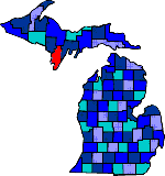
| French-Canadian Louis Chappieau started a fur-trading business in the late 1790's. The first sawmill was opened in 1832 on the Menominee River. In the 1900's agriculture began to replace lumbering with first school of agriculture in Michigan established in Menominee County. Today Menominee County industry is dairying as well as farming. Its industrial center consists of wood, metal fabrication, furniture and paperboard. |
| Carney (49812) | Cedar River (49813) | Daggett (49821) |
| Harris (49845) | Hermansville (49847) | Ingalls (49848) |
| Menominee (49858) | Nadeau (49863) | Perronville (49873) |
| Powers (49874) | Spalding (49886) | Stephenson (49887) |
| Wallace (49893) | Wilson (49896) |
|
Copyright | 2021 | michiganweb.com
|