| Size: 712 Square Miles |
| Elevation: 700-900 Feet |
| Physiography: Rolling plains |
| Growing Season: 130-150 days |
| Annual Precipitation: 30-32 inches |
| Average Snowfall: 40-60 inches |
| Forest Type: Oak-Hickory, Maple-Beech, Birch-Hemlock, Elm-Ash-Cottonwood |
| Fall Colors: Early October |
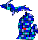
| Named after the French General Marquis de Montcalm. Settlement began in 1831. By 1850 the county was officially organized with Greenville as its temporary county seat, which later became Stanton. Settlers came to farm the land, and others took advantage of the pine forests. Lumbering began after the Civil War and ended by 1900. In 1892 the Ranney Refrigerator Company was built. Agriculture remains Montcalm County's main industry. More Cucumbers are grown here than any other county in the US. There is also a large potato and dry bean crops, as well as many gas and oil wells. |
| Amble | Amsden | Bushnell |
| Butternut | Carson City (48811) | Cedar Lake (48812) |
| Coral (49322) | Crystal | Edmore (48829) |
| Fenwick (48834) | Gowen (49326) | Greenville (48838) |
| Howard City (49329) | Kendalville | Kings Corner |
| Lakeview (48850) | Langston | Maple Hill |
| McBrides (48852) | Pierson (49339) | Reynolds |
| Riverdale (48877) | Sand Lake (49343) | Shanty Plains |
| Sheridan (48884) | Sidney (48885) | Six Lakes (48886) |
| Stanton (48888) | Tamarack | Trufant (49347) |
| Vestaburg (48891) | Westville | Wyman |
|
Copyright | 2021 | michiganweb.com
|