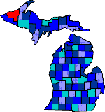

| Size: 1316 Square Miles |
| Elevation: 600-1800 Feet |
| Physiography: Lake-border Plains, hilly uplands |
| Growing Season: 60-120 days |
| Annual Precipitation: 31-35 inches |
| Average Snowfall: 110-180 inches |
| Forest Type: Aspen-Birch, Maple-Hemlock |
| Fall Colors: Late September |
| Ontonagon River played a major role for explorers, missionaries and Indians. In 1843 the first white was at the mouth of the Ontonagon River. On the river was a huge copper rock known as the Ontonagon Boulder. This boulder is now at the Smithsonian Instution in Washington DC. A lot of mines were opened but didn't do that well. Most prospectors left in 1849 for California. The lumbering industry at that time was destroyed by a fire in 1896. Slowly the lumbering production came back. |
| Bergland (49910) | Bruce Crossing (49912) | Ewen (49925) |
| Greenland (49929) | Lake Gogebic | Mass city (49948) |
| Merriweather (49947) | Ontonagon (49953) | Rockland (49960) |
| Trout Creek (49967) | White Pine (49971) |
|
Copyright | 2021 | michiganweb.com
|