| Size: 961 Square Miles |
| Elevation: 600-900 Feet |
| Physiography: Rolling plains, lake border plains |
| Growing Season: 140-160 days |
| Annual Precipitation: 29-32 inches |
| Average Snowfall: 40-60 inches |
| Forest Type: Aspen-Birch, Maple-Beech |
| Fall Colors: Early October |
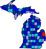
| The first settlers came in 1834 and by then most of the Chippewa Indians were gone. After lumbering, agriculture became the leading industry. Sanilac County hasn't one natural lake but has sandy beaches and a shoreline that attract visitors. Native Americans carved a stone of early hunters, symbols and animals and can be seen at the Sanilac County Petrogylphs. |
| Amadore | Applegate (48401) | Argyle (48410) |
| Brown City (48416) | Burnside (48416) | Carsonville (48419) |
| Cash | Charleston | Croswell (48422) |
| Cumber | Decker (48426) | Deckerville (48427) |
| Downington | Elmer | Forester |
| Forestville (48434) | Freidberger | Hemans |
| Juhl | Laing | Lexington (48450) |
| Marlette (48453) | Melvin (48454) | Minden (48456) |
| Palms (4865) | Peck (48466) | Port Sanilac (48469) |
| Richmondville | Roseburg | Sandusky (48471) |
| Shabonna | Snover (48472) | Speaker |
| Trye | Valley Center | Watertown |
| Wickware |
|
Copyright | 2021 | michiganweb.com
|