| Size: 508 Square Miles |
| Elevation: 700-900 Feet |
| Physiography: Rolling Plains |
| Growing Season: 140-160 days |
| Annual Precipitation: 33-35 inches |
| Average Snowfall: 40-60 inches |
| Forest Type: Maple-Beech, Oak-Hickory |
| Fall Colors: Mid October |
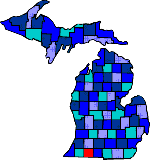
| The Potawatomie and Miami tribes occupied the St Joseph County area first. Later on pioneers settled enjoying the fertile land. The St Joseph River supplied a power source for Sturgis. The longest covered bridge in Michigan the Langley Covered Bridge, built in 1887, still remains. |
| Burr Oak (49030) | Centreville (49032) | Chamberlains |
| Colon (49040) | Constantine (49042) | Corey |
| Fabius | Factoryville | Fairfax |
| Findley | Florence | Flowerfield |
| Howardsville | Klingers | Leonidas (49066) |
| Mendon (49072) | Mint | Moore Park (49093) |
| Mottville | Nottawa (49075) | Oakwood |
| Parkville | Perrin | Pine Ridge |
| Sturgis (49091) | Three Rivers (49093) | Wasepi |
| White Pigeon (49099) |
|
Copyright | 2021 | michiganweb.com
|