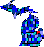

| Size: 816 Square Miles |
| Elevation: 600-900 Feet |
| Physiography: Rolling plains, lake border plains |
| Growing Season: 120-140 days |
| Annual Precipitation: 28-30 inches |
| Average Snowfall: 40-50 inches |
| Forest Type: Aspen-Birch, Maple-Beech-Hemlock |
| Fall Colors: Early October |
| In 1835 pioneers came from New York. With the opening of a mill in 1850 more settlers came to the area. Logging became the leading industry. There were two major fires in the county one in 1871 and then in 1881. The later burned homes, barns and 2 sawmills. As logging dwindled farming grew. |
| Akron (48701) | Bradleyville | Caro (48723) |
| Cass City (48726) | Colling | Colwood |
| Dayton | Deford (48729) | Ellington |
| Elmwood | Fairgrove (48733) | Fostoria (48435) |
| Gagetown (48735) | Gilford (48736) | Juaniata |
| Kingston (48741) | Mayville (48744) | Millington (48746) |
| Oakhurst | Quanicasse | Reese (48757) |
| Richville (48758) | Silverwood (48760) | Thomas |
| Tuscola (48769) | Unionville (48767) | Vassar (48768) |
| Wahjamega | Watrousville | Wilmot |
| Wisner (48862) |
|
Copyright | 2021 | michiganweb.com
|